
Day 147
ZERO
Kiki, Trouble, Bin Chicken, Trash Panda were among the folks who got the air b&b and let us crash. We helped clean up in the morning and then my friend Levi who lives in the area came and picked all of us up. We all had free coupons to the Black Bear Diner so we went there for our free breakfast.

After breakfast we all went to the highline that is set up in Bend. The walking line is about a 30 foot climb up a tree, I was too scared to go up at first. Kiki, having been on a descent amount of highlines, went up and out first and then helped Toro, Trouble & Bin Chicken get out on their first highlines. Then, having secured a piece of gear that would make me feel more secure climbing the tree, I faced my fear and went up and helped Fish Fry, Aiden and Trash Panda get on their first highlines!
Mantis and I were trying to get a bus back to sisters at 5 so I only had time to go out for about 5 minutes before we had to leave. It was so cool getting so many pals out in their first lines ever!

Mantis and I caught the bus to sisters and then got a quick hitch up the pass back to trail. As we drove up it got cloudier and cloudier until when our driver dropped us off it was raining. We begrudgingly got out of the car and took some shelter near the privy up there. We eventually found a place to set up camp when the rain had slowed down a bit.
Day 148
Start: 2002 End: 2028.3 Total: 26
It drizzled a bit the following morning and the trail was covered in a layer of fog. It got more windy the higher we climbed but didn’t rain too much after we started walking. We began in a burn zone but the trail was lined with huckleberry bushes!

We passed Glow Worm early on and had an uphill climb for most of the morning. Near the top, views to the east opened up but we kept going deeper into the cloud. We arrived at what was the top of the climb, which was supposed to have views of a well known mountain “Three Fingered Jack”. The top, however, was covered in a cloud. We sat there for a bit and chatted with a couple other hikers but it was quite cold so we kept moving.


We went down a set of steep switchbacks, going below the cloud now. We stopped a couple times, hoping to sneak a view of Three Fingered Jack but the cloud hung tightly to the top. At the bottom we entered into another burn zone and soon started going uphill once again.

Once we hiked a ways away we finally got our view of the mountain! We did about 14.5 before having lunch at a nice lake. We met a SOBO who said it would be a burn zone for the next 60 miles. We were astonished and that sucked the excitement we had out of the next stretch.

After lunch there was another smaller burn section but followed by a longer lush forested section with many views of Mt. Jefferson. It seemed like the SOBO hiker was exaggerating a bit.


The SOBO also told us of an alternate from the PCT, it didn’t change the mileage much but it had a lot of berries and some lakes. We took it and went down a lot in elevation right away. We walked through a very lush rainforest like ecosystem. The trail was a bit overgrown at times but was lined with all sorts of berries. Some we knew for sure we could eat, others we weren’t so sure.


Mantis collected a bunch of Salmonberries that his phone identified but it did not say if they were edible so he just held onto them. We eventually texted my sister in law Bri on my sat phone and she informed us they were edible!


We descended about 3000 feet and made our way to the shores of a beautiful lake and made camp a bit back in the woods. We ate dinner on the lake then went to sleep!

Day 149
Start: 2028.3 End: 2052.4 Total: 24.1
We woke up and got on trail pretty quickly. It was a much shorter climb to get back to the PCT, only a couple hundred feet. When we got back on trail we saw Five Moons, who we camped with back at Sierra City.
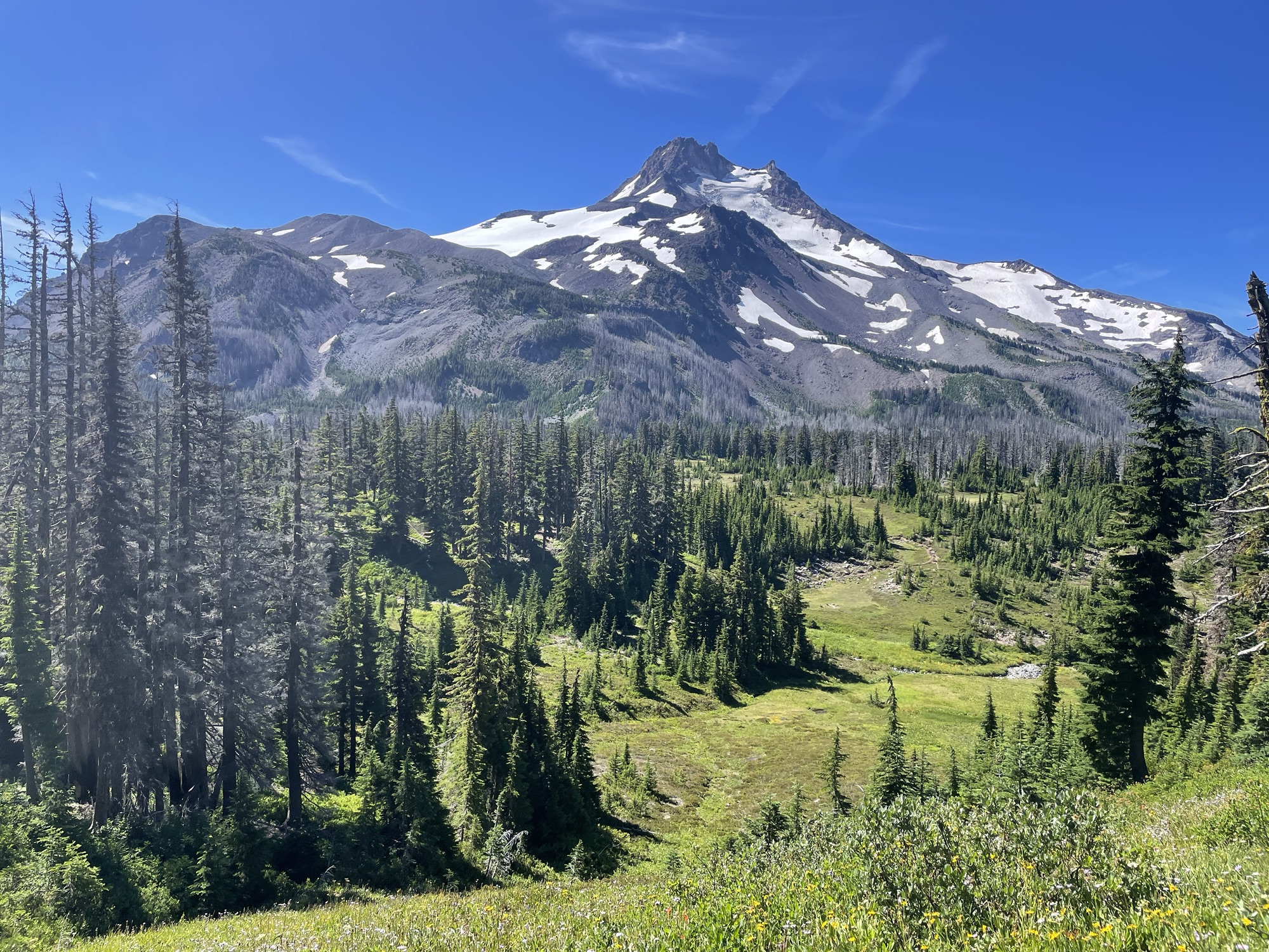
We also had a totally new vantage point of Mt. Jefferson. It was so cool seeing it from afar and it grow closer and closer each day. Now we had walked to the side of it and it looked like a totally different mountain.

We climbed about 500 feet through the forest and there were tons of Huckleberries. It was quite distracting and we weren’t moving very quickly as we kept stopping to pick handfuls. At the top of that climb we entered another burn area. I thought the climbing was done but Mantis informed me we still had another 2500 feet of climbing!


My back was really hurting from the load of my pack. We stopped and sat on a log for 10 minutes and stretched our backs and mentally prepared for this climb in the burn. we climbed for a bit but the burn eventually turned into a green meadow and forest surrounding Mt. Jefferson.

We stopped and filtered water and a couple from Israel, Leah & Ido made us some Turkish coffee by the stream. The coffee had us jazzed for the last 500 feet of climbing and we were greeted with awesome views of both Mt. Jefferson in the rear view and Mt. Hood coming up!


There was a couple snow patches on the decent and it was about Rocky as we made our way down. We had a couple other nice views of Mt. Hood and eventually made it to a large pond for lunch. We took a quick dip, had a quick lunch and got back on trail!

We went another mile before taking a short cut to get to Ollalie Resort. We took a side trail through a very burnt and destroyed area, it was hard to follow but you could see a faint trail through all the ash and downed trees. We then got to a forest road and took that a couple miles around two beautiful lakes surrounded by burnt trees.

We got to a small resort on this lake and purchased a couple beers and played some cards with Five Moons. We had dinner then Mantis and I hiked out about 4 more miles to another lake and slept there for the evening.

Discover more from Trekking Home
Subscribe to get the latest posts sent to your email.